Lee Han Modernizing Traffic Research to Improve Roads, Save Lives
For most Americans, traffic is a twice-daily annoyance.
For visitors to Gatlinburg, Tennessee, on November 28, 2016, traffic was a matter of life and death.
“During tourist season, Gatlinburg swells from a population of about 4,000 up to 100,000,” said Professor Lee Han, a specialist in traffic engineering. “When the wildfire swept in that day, you couldn’t just worry about the residents. The tourists were not familiar with the area, so they didn’t know where to go, and we couldn’t predict where they were.”
At the time, there was no way to track the tourists’ attempted evacuation routes or to recommend alternatives. After the fire, Han started working to ensure that such disasters could be more safely managed in the future. With support from the Federal Highway Administration (FHWA) and the Tennessee Department of Transportation (TDOT), Han started crowdsourcing traffic data from smartphone GPS programs.
Traffic Circles Back to Normal
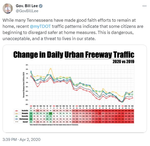
Four years later, during the start of the COVID-19 pandemic, Han’s team was able to supply TDOT with data showing that Tennesseans were returning to their normal driving routines too quickly. Tennessee Governor Bill Lee tweeted a graph of Han’s data and announced more stringent stay-at-home requirements, decrying the uptick in traffic as a threat to citizens’ safety.
The Gatlinburg wildfire, the COVID-19 pandemic, and similar events demonstrate what Han has known for decades: traffic is worth examining.
“I think traffic is something that everybody talks about and that everyone has a stake in, but that few people do anything about,” he said. “Fortunately, I and a lot of other scientists are interested in understanding and improving the system.”
Working With TDOT
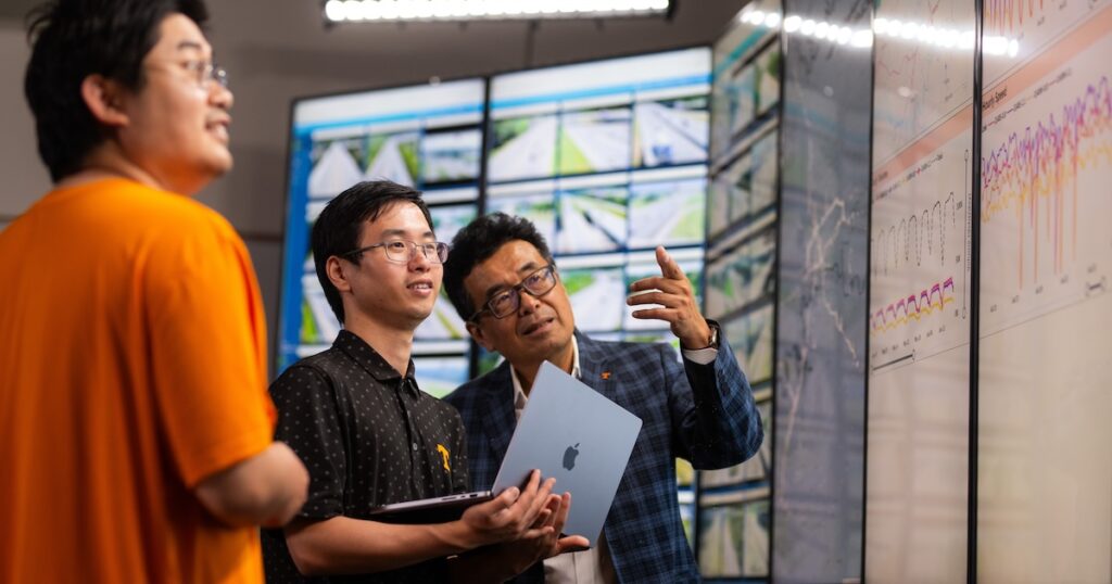
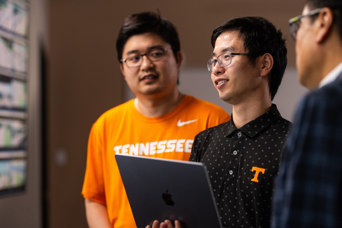
Han came to Tennessee and began his partnership with TDOT and FHWA about 30 years ago, back when printed traffic data cluttered up storerooms. He was there in 1999 when TDOT installed radar and video stations to monitor traffic along the major highways across the state. Now, Han integrates those station readings with crowdsourced data like smartphone GPS signals.
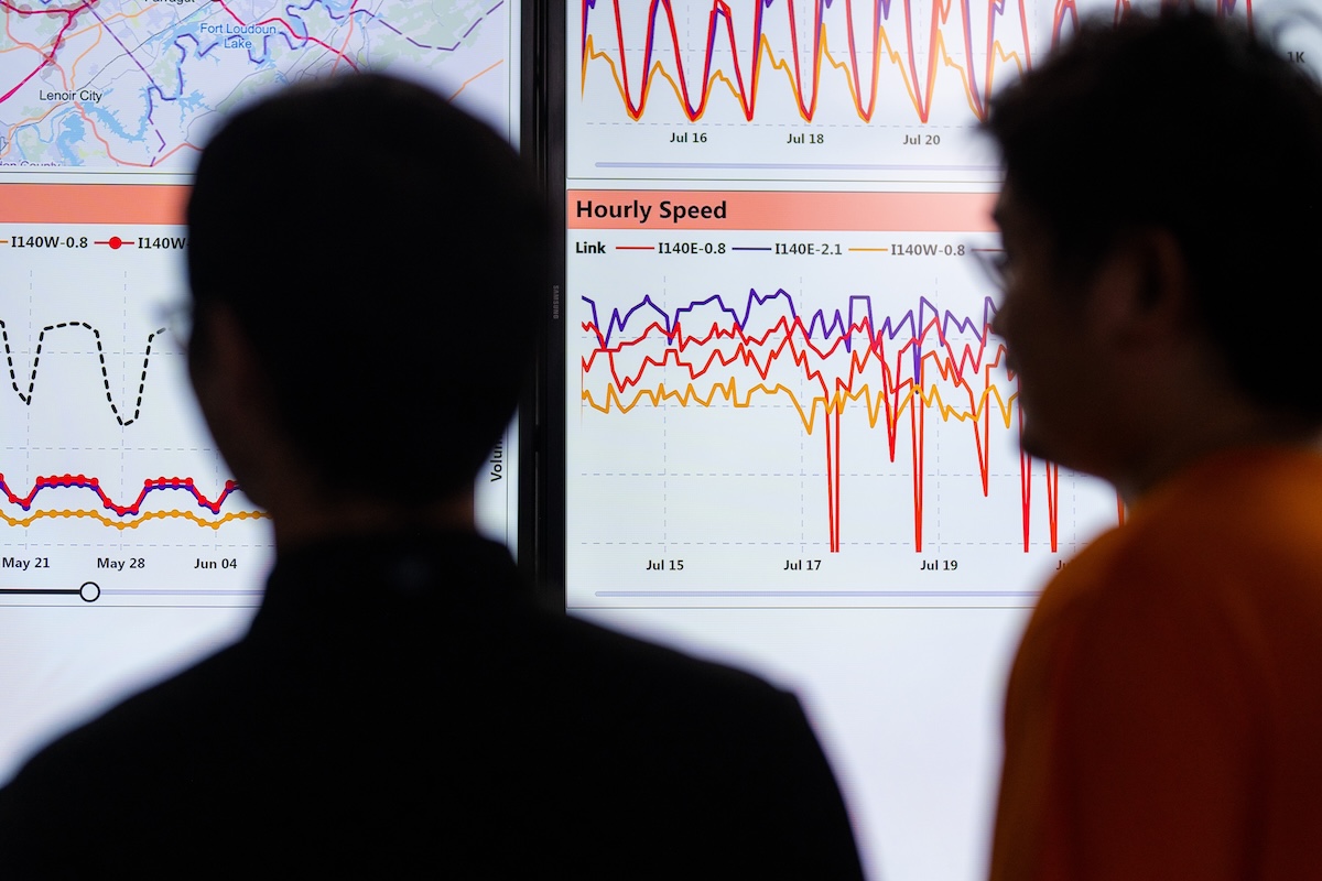
Over the last decade, he has created dozens of virtual dashboards that visualize patterns in the data, helping inform transit decisions on multiple timescales—whether to efficiently mobilize emergency response teams to crashes on the interstate or help the government identify the areas most in need of repair, management, or construction.
Revolutionizing Pothole Repair
Han often has a goal in mind when he sifts through the billions of data points coming in from stations and cell phones every day, but he is also open to seeing what patterns emerge naturally. Recently, he and his former student, Research Assistant Professor Yangsong Gu, revolutionized the way TDOT handles pothole reporting and repair.
TDOT takes potholes seriously. The department has a hotline and a website where people can report pothole locations. Unfortunately, drivers need to wait until they arrive at a destination to safely report issues by those methods. That means the reports TDOT receives may not be complete or fully accurate.
Han and Gu recently partnered with Google to gather crowdsourced traffic data via a traffic and navigation app called Waze. The app’s central hazard and traffic reports are updated every two minutes, so Han and Gu’s team can observe problems arising in real time—which is especially helpful on surface streets and in rural areas, where traffic monitoring stations are not present.
Han’s team realized that the hazard reports had strong potential directing pothole repairs.
“If you have Waze open when you hit a pothole, you can click the ‘Pothole’ button and it takes your exact location for the report,” Han said. “Each person using Waze on a cell phone is a mobile traffic station.”
Han and Gu presented TDOT with a dashboard showing the location of each pothole, with the number of reports at each location serving as a proxy for a pothole’s severity and traffic impact. They were pleasantly surprised by the department’s enthusiastic response.
“Potholes themselves aren’t exciting,” Han said. “However, being able to know precisely where the potholes are, across an entire state, for free—that is exciting. It’s a very useful tool that TDOT and the FHWA didn’t have to spend any additional money to implement.”
As increasing amounts and types of data become available, Han believes that integrating a variety of perspectives will be key to new revolutions in traffic analysis.
“Civil and environmental engineering is becoming ever more multifaceted,” he said. “I am working with students who have backgrounds in computer science, data science, geography, and psychology. In my lab, I emphasize their ability to follow the logic, to do the research the data demand. That’s what we’re here to do—we’re pushing the envelope, pushing the boundary of human knowledge.”
Contact
Izzie Gall (865-974-7203, egall4@utk.edu)